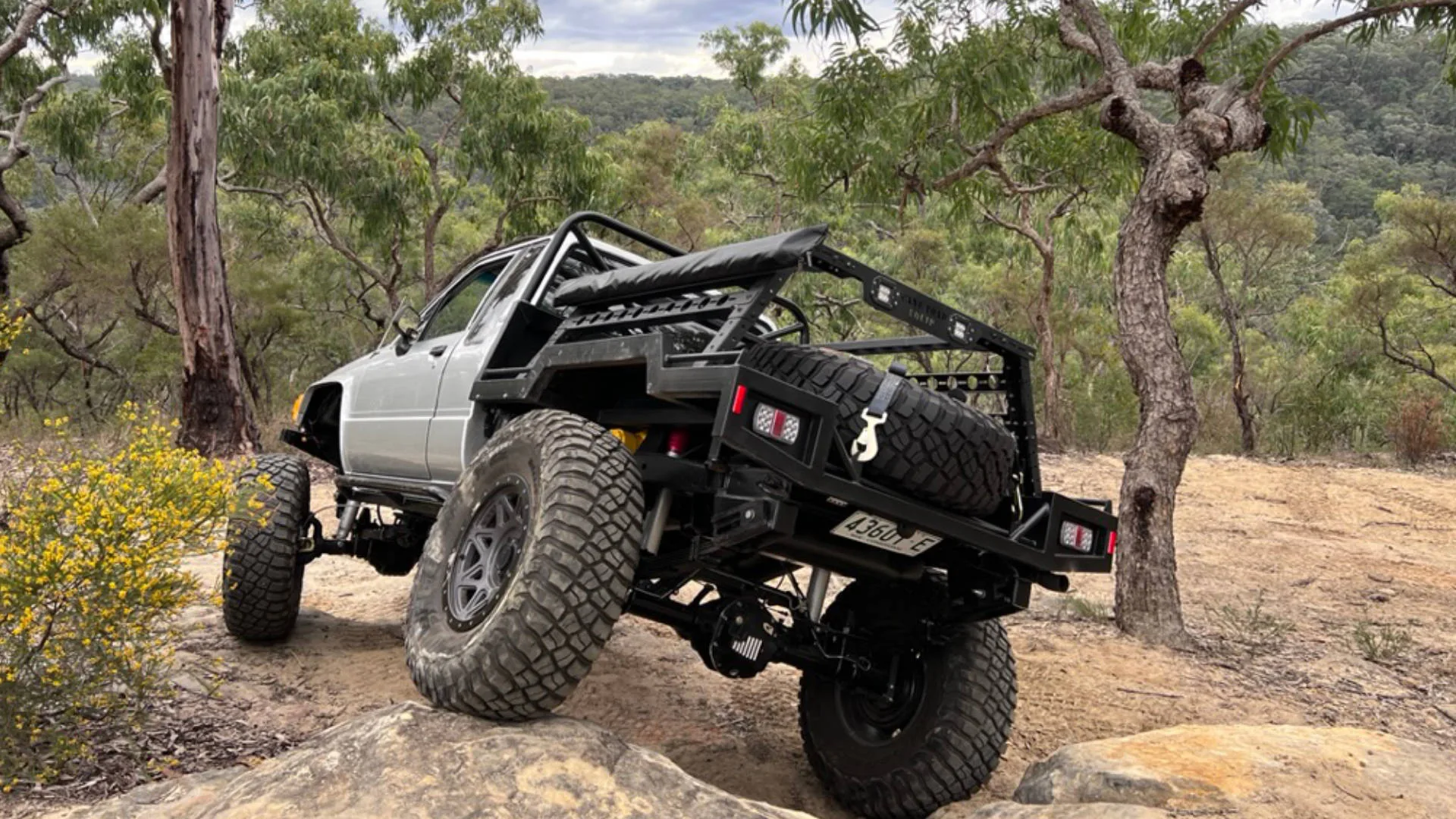
If you're a four-wheel driver and you've heard vague rumours about rock climbers fighting some ban at Mount Arapiles in Victoria, you've probably filed it away as someone else's problem. Fair enough. Climbing isn't 4WDing.
But the same kind of legal machinery being used to restrict climbing at Arapiles is already being used to restrict 4WD access in places like Kati Thanda–Lake Eyre, and it underpins every new national park management plan being drafted across Victoria, South Australia, and NSW.
This article isn't really about climbing. It's about the way access to public land is being reshaped — and why, if you drive a 4WD on public land anywhere in Australia, what's happening at Arapiles now is very likely a preview of what's coming for you.
A Bit of Context First
I want to be upfront about something before I go further. My wife has Indigenous heritage, and so do my kids. I'm not writing this as someone who dismisses Aboriginal culture or wants to wind the clock back on native title.
What concerns me is a legal and governance architecture that has been built, piece by piece, around recreational access to public land — one that most Australians have never heard of, that has had very little parliamentary or public scrutiny, and that allows permanent closures of Crown land with limited appeal, limited independent evidence review, and no compensation.
The same mechanisms that can shut climbers out of a cliff can be used to shut drivers out of a track, walkers out of a trail, or boaters out of a ramp. And if nothing changes, that architecture leads us toward a system where access to public land depends on who you are rather than being a right that belongs equally to all Australians.
What's Happening at Arapiles — The Short Version
Mount Arapiles (Dyurrite) near Horsham in Victoria is Australia's premier rock climbing destination. It sits in a state park — public land — and climbers have been visiting it for over sixty years.
A government-led process, developed with Barengi Gadjin Land Council (BGLC) and other stakeholders, is now well advanced to formally regulate climbing through a Dyurrite-specific cultural landscape framework. Climbing access groups warn that under current drafts, a majority of established climbing areas — widely described as around 60 percent — could be closed or heavily restricted on a permanent basis.
This isn't a temporary safety closure or a seasonal restriction. It's a permanent reshaping of how the park can be used, with climbing removed or tightly controlled in large areas, and a formal role created for the regional Aboriginal representative body in deciding what uses are acceptable.
The climbers pushing back aren't arguing against Aboriginal rights. They're arguing against a system where access is removed or tightly controlled on cultural heritage grounds using processes and evidence that they cannot properly scrutinise.
Uluru — The Prototype
Uluru is the clearest, most high-profile example of recreational access being permanently removed on cultural heritage grounds. For decades people climbed it; in 2019, the summit track was closed and the climb was banned as part of a long-running push by Anangu Traditional Owners and park managers.
Whether you agreed with that decision or not, the precedent is important. A major national icon, on Commonwealth land, went from open to permanently closed for recreational use on cultural and spiritual grounds. There was no alternative route, no seasonal compromise, and no real avenue for appeal.
In my view, Uluru was the prototype: a test case that showed governments they could permanently remove long-standing recreational uses of public land on cultural heritage grounds, and that once the closure was in place, public debate would move on.
The Mechanism — and Why It Matters to You
In Victoria, the critical legislative backdrop is the Aboriginal Heritage Act and the Aboriginal Heritage Regulations 2018. Those Regulations broadened "areas of cultural heritage sensitivity" to include wide categories of parks and reserves managed for conservation purposes, so that significant works or activities in many parts of those areas can now trigger a Cultural Heritage Management Plan (CHMP).
In practice, this means that in a park like Arapiles:
- Cultural heritage values are mapped and assessed across the landscape.
- A Registered Aboriginal Party (in this case BGLC) has defined statutory roles in how those values are identified and protected.
- A Dyurrite-specific "decision framework" or guidance document sets out which activities are considered hazards to those values and where they can or cannot occur.
Once you have that framework in place, it does not care whether the activity is climbing, building a track, driving a 4WD, or installing a boat ramp. The logic is the same: identify heritage, define risk, and restrict or prohibit activities seen as hazardous.
Right now, climbers are the obvious target because their activity is concentrated on particular cliffs. But the same logic, applied word-for-word, can be used on access tracks, campsites, and any other form of recreation in a park.
The Rock Chip Problem
At Arapiles, one of the key physical artefacts in play is the stone quarry scar — the "rock chip." These are small depressions or scars where Aboriginal people struck stone flakes for tools.
A few things matter about these:
- They're not rare. Wherever you had suitable rock and long-term occupation, you can have quarry scars. That covers most of Australia.
- They're almost invisible to anyone who isn't trained to spot them. You could walk past one a hundred times and not know it.
- They can be identified in places previously thought to be clear, especially as surveys become more detailed. Climbing Victoria has documented areas surveyed and cleared that are now being re-closed because new artefacts have been identified.
On top of that, you have "intangible cultural heritage": men's places, women's places, ceremonial landscapes, and other values that are not visible on a map and are often held as confidential by Traditional Owners.
I'm not questioning that these values exist. I'm saying this: when critical evidence about why a site is being closed is confidential, and when stakeholders are asked to sign non-disclosure agreements before they can even sit at the table, you create a situation where decisions can't be properly tested or appealed.
You cannot meaningfully contest evidence you are not allowed to see. And once you normalise that, you've built a system that can justify almost any closure, anywhere, without transparent scrutiny.
It's Already Happening to 4WDers
If you think this is just a climbing problem, you're already behind the curve.
Kati Thanda–Lake Eyre, South Australia
Kati Thanda–Lake Eyre is Arabana Country. Draft management plans have proposed banning recreational activity on the lake bed — driving, walking, boating — unless visitors have explicit permission from Arabana Traditional Owners, with general public access limited to designated viewpoints and managed exemptions.
The lake has been a destination for 4WD tourers, adventurers, and outback travellers for decades. It's public land, funded by public money, managed by a government agency. Under the proposed framework, access to the lake surface itself would depend on authorisation from a Traditional Owner body.
The Lake Eyre Yacht Club put it plainly: this amounts to "effectively privatising the national park."
Whether or not you agree with the direction, the trend is clear: the combination of park plans and cultural heritage obligations is being used to turn open landscapes into tightly regulated spaces.
Rangers and Helicopters
In South Australia, park agencies have stepped up enforcement on beaches and dunes. Rangers have used aerial patrols, including helicopters, to monitor 4WD activity in coastal areas and have issued fines for dune damage.
I'm not arguing that every fine is unjust — some people do drive irresponsibly. But when you're running helicopter patrols to catch recreational 4WDs, you're looking at an enforcement posture that treats casual access as something to control hard, not as the default starting point.
NSW — Buying Up the Country
Over the last decade, the NSW Government has been steadily acquiring large pastoral properties in the west and converting them into national parks and reserves. These acquisitions are frequently in the tens of thousands of hectares — including properties near Broken Hill, 800km west of Sydney.
Every time that happens, the road network and station tracks across those properties move from a world where access might be negotiated with a landholder or via stock routes into a world where every track is subject to a formal management plan. Those plans frequently limit vehicle access to selected routes, close or "rehabilitate" old mustering tracks, introduce seasonal closures, and embed joint management arrangements with Traditional Owners that give them a formal say in what uses are acceptable.
Then there's the Great Koala National Park proposal on the NSW Mid North Coast — a huge amalgam of existing state forests and reserves, proposed to be consolidated under a national park banner. Whatever you think of the conservation goals, the practical effect is predictable: large areas that were previously used for 4WDing, dispersed camping, trail bike riding, and hunting will shift into a more tightly regulated regime with new rules, new gates, and less informal access.
The pattern is always the same. Land that once had a relatively flexible, practical access culture gets absorbed into a more regulated, plan-driven system where recreational use is just one factor among many — and often not the priority.
The Financial Dimension — Why This Isn't Going Away
Follow the money and the picture gets clearer.
Barengi Gadjin Land Council, as the representative body for the Wotjobaluk, Jaadwa, Jadawadjali, Wergaia, and Jupagulk peoples, signed a Recognition and Settlement Agreement with the Victorian Government in 2022. Public summaries describe tens of millions of dollars in funding over an initial period, plus $2.6 million per year ongoing for land management programs.
In parallel, BGLC and the State signed a Land Use Activity Agreement (LUAA) in April 2026 under Victoria's Traditional Owner Settlement Act. That agreement gives BGLC defined procedural rights over certain categories of activities on Crown land within their area. For those activities, agencies like Parks Victoria must consult BGLC and give their advice serious weight before making decisions. The LUAA can also carry benefit-sharing arrangements linked to resource projects on Crown land — so the more land and the more activity categories a Traditional Owner body has jurisdiction over, the more potential benefit it receives.
I'm not saying BGLC are villains. I'm saying the structure of the system creates a very clear incentive for jurisdiction and regulatory reach to expand, not contract.
On the government side, the logic is just as clear: settle the claims, sign the agreements, claim political credit for "delivering Treaty" or "strengthening heritage protections," and let recreational users absorb the cost in the form of lost access. No compensation. No equivalent rights for the people who lose access. Very little public debate about whether the trade-offs are proportionate.
The Pattern
If you're wondering whether all of this is just a pile of unrelated decisions across different states — or something more structural — look at the sequence.
- 2018: Victoria updates its Aboriginal Heritage Regulations, broadening "areas of cultural heritage sensitivity" to parks and reserves.
- 2019: Uluru's summit is permanently closed to climbing on cultural heritage grounds — the high-profile prototype.
- ~2020: Large-scale climbing restrictions begin at the Grampians/Gariwerd — thousands of routes effectively taken off the table under cultural heritage and park management frameworks.
- 2022: The Wotjobaluk settlement with BGLC is signed, embedding new governance layers over Crown land in north-west Victoria.
- 2024–2026: The Dyurrite/Arapiles process develops a detailed cultural landscape framework for climbing, with significant proposed closures.
- 2024 onwards: Draft plans at Kati Thanda–Lake Eyre propose restricting access to the lakebed subject to Traditional Owner permission.
- April 2026: BGLC signs the LUAA — formalising their role in decisions across Crown land in north-west Victoria.
- In parallel: Large new parks and park proposals — including the Great Koala National Park — consolidate previously accessible forests and bush into tightly managed conservation estates.
Different states, different statutes, same direction of travel: build legal frameworks where cultural heritage and Traditional Owner agreements sit on top of park management, then use that combined structure — plus large new park declarations — to restrict or reshape recreational access.
The Two-Class Problem
Here's the part that nobody with a political or media platform seems willing to say plainly.
These frameworks give registered Traditional Owner bodies legal roles and consultation rights that other citizens and clubs simply do not have. In some categories of activity, nothing significant can happen on Crown land without their input and, in practice, their consent.
When those roles include effective power to approve or block access, and when the evidence underpinning those decisions is often confidential or subject to NDAs, the system starts to function like a two-class regime:
- One class of Australians has formal, legally recognised authority over how public land is used, tied to ancestry and cultural status.
- Everyone else is a visitor, subject to rules and closures they cannot meaningfully influence or challenge.
I understand why these frameworks were created. Australia's history toward Aboriginal people is ugly, and there were real injustices to correct. But there is a point where a system built to deliver justice for one group starts to erode basic principles of equal citizenship for everyone.
A country where one group of citizens has permanent, effectively unchallengeable authority over where another group can go on land that everyone's taxes fund is not, in my view, a reconciled country. It's a two-class system with better branding.
What You Can Do
This isn't the kind of system that changes on its own. It changes when enough people understand it and push back in the right places.
Know your park's management plan. Every national park has a plan of management. Those documents are public and set the rules for access. When they're up for review, there's a consultation process. Most plans get approved with little or no submission from recreational users simply because people don't know the process is happening.
Watch land acquisitions and new parks. When a station near you is turned into a national park, or when a big new proposal like the Great Koala National Park is announced, don't assume existing 4WD access will continue. Read the plan. Ask questions. Look for what's being closed, not just what's in the glossy brochure.
Support access advocacy groups. In Victoria, bush user groups, 4WD associations, and climbing organisations are doing the hard work of reading documents, attending meetings, and trying to keep some balance in these decisions. Most are small volunteer outfits facing well-funded, legally sophisticated institutions. Numbers matter.
Be wary of NDAs. If you or your club are invited onto a "working group" or "stakeholder panel" and asked to sign a non-disclosure agreement, understand what that means. You are lending your legitimacy to a process you might never be able to fully explain to your own members.
Raise it politically. Track closures and access changes in marginal or regional electorates matter. Local MPs and ministers need to hear that their constituents are paying attention to park plans, LUAA negotiations, and heritage-driven closures — not just to headlines about "more funding for national parks."
The Bottom Line
The same type of framework being used to restrict climbers at Arapiles is already reshaping access at Kati Thanda–Lake Eyre and underpins every major new park declaration or management plan update across the country.
It isn't a conspiracy. It's a legal architecture built over the last decade: heritage laws, Traditional Owner settlements, land use agreements, and park management plans, all interacting in ways most ordinary users never see.
Climbers are simply the first large user group to feel the full weight of it at a high-profile site. In my view, 4WDers, bushwalkers, hunters, and other outdoor users are not far behind.
If you value open access to public land — regardless of whether you climb, drive, walk, or paddle — now is the time to pay attention. Not in five years when the gates are already locked.
Sources
Dyurrite / Arapiles / BGLC
- Climber accounts highlight tensions around ranger interactions at Mt Arapiles/Dyurrite — Vertical Life, 11 April 2026
- Where Things Actually Stand: Dyurrite, The Climbing Company, and What Comes Next — The Climbing Company, 24 April 2026
- Dyurrite Update from the SWG Meetings — The Climbing Company, 15 May 2026
- Climbing bolts removed from Millennium Cave in the Grampians — ABC News, 17 October 2023
- ACAV: Millennium Cave postponed — ACAV, 25 May 2023
- Aussie Life: Climb It Denier — The Spectator Australia, 15 November 2025
- Local Victorian art prize awarded for connection to culturally significant site — NITV / NIT, 10 February 2026
- Wotjobaluk Nations take their seat at the table — NITV / NIT, 3 May 2026
- Dyurrite Guidance Framework — Draft, 24 April 2026
Victorian Heritage Legislation
- Aboriginal Heritage Regulations 2018 — Regulatory Impact Statement (PwC/Victorian Government)
- Office of the Commissioner for Better Regulation — Aboriginal Heritage Regulations assessment letter, 2018
- Taungurung Land Use Activity Agreement (template for BGLC's 2026 LUAA) — Victorian Government, 2018/2020
- Yoorrook Justice Commission Records Bill 2024 — Victorian Parliament
Uluru
Kati Thanda–Lake Eyre
Great Koala National Park
Stephan Fischer runs AllOffRoad, an Australian four-wheel drive and outback travel channel. Research for this article draws on the ACAV (Australian Climbing Association Victoria) Facebook community, Victorian Government legislation and regulatory documents, and publicly available national park management documentation.